


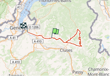
SAINT JEOIRE COLDE JOUX PLANE

leclaude74
User

Length
96 km

Max alt
1693 m

Uphill gradient
2067 m
Km-Effort
124 km

Min alt
407 m

Downhill gradient
2200 m
Boucle
No
Creation date :
2024-08-11 06:08:17.381
Updated on :
2024-08-13 07:45:32.844
3h39
Difficulty : Very difficult

FREE GPS app for hiking
 SityTrail
IGN / Geographical institutes
SityTrail Plus
The world is yours!
About
Trail Road bike of 96 km to be discovered at Auvergne-Rhône-Alpes, Upper Savoy, Saint-Jeoire. This trail is proposed by leclaude74.
Positioning
Country:
France
Region :
Auvergne-Rhône-Alpes
Department/Province :
Upper Savoy
Municipality :
Saint-Jeoire
Location:
Unknown
Start:(Dec)
Start:(UTM)
303097 ; 5112404 (32T) N.
Comments