


loisy SM

vivivivi77
User
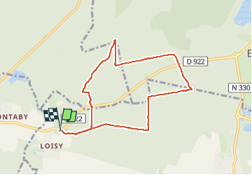

Length
8.1 km

Max alt
118 m

Uphill gradient
60 m
Km-Effort
8.9 km

Min alt
87 m

Downhill gradient
61 m
Boucle
Yes
Creation date :
2024-08-13 07:15:54.816
Updated on :
2024-08-13 09:43:21.842
2h26
Difficulty : Medium

FREE GPS app for hiking
 SityTrail
IGN / Geographical institutes
SityTrail Plus
The world is yours!
About
Trail Walking of 8.1 km to be discovered at Hauts-de-France, Oise, Ver-sur-Launette. This trail is proposed by vivivivi77.
Description
midif du parcours
Positioning
Country:
France
Region :
Hauts-de-France
Department/Province :
Oise
Municipality :
Ver-sur-Launette
Location:
Unknown
Start:(Dec)
Start:(UTM)
473891 ; 5440114 (31U) N.
Comments