


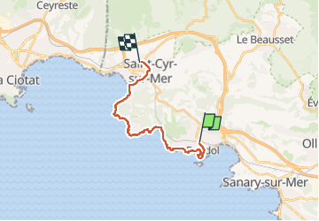
Bandol - St Cyr par le sentier du littoral

Bart2015
User


4h54
Difficulty : Very difficult

FREE GPS app for hiking
 SityTrail
IGN / Geographical institutes
SityTrail Plus
The world is yours!
About
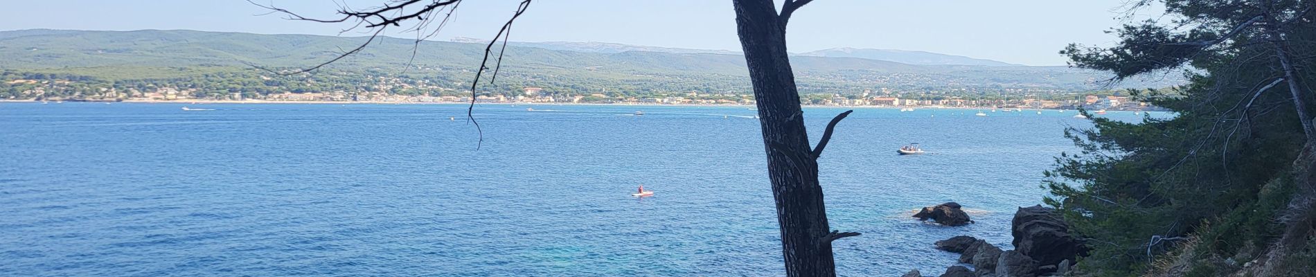
Trail Walking of 17.2 km to be discovered at Provence-Alpes-Côte d'Azur, Var, Bandol. This trail is proposed by Bart2015.
Description
Belle balade matinale (en été) faite dans le sens Bandol - St Cyr pour avoir le soleil de dos. Départ gare Bandol pour retour en train. Le circuit est très ombragé et permet de belles vues sur les côtes. A la Pointe Fauconnière, laisser le balisage jaune et prendre le chemin longeant la côte, attention passage avec câble ....
La balade peut bien sûr être faite dans l'autre sens.
Bonne rando, soyez prudent et respectueux du site ...
Photos


Positioning
Comments