


tenis de poigny la Forêt 9km2

topophil
User
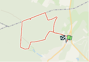

Length
9.2 km

Max alt
183 m

Uphill gradient
105 m
Km-Effort
10.6 km

Min alt
152 m

Downhill gradient
104 m
Boucle
Yes
Creation date :
2024-08-14 07:27:49.006
Updated on :
2024-08-14 10:15:04.321
2h46
Difficulty : Medium

FREE GPS app for hiking
 SityTrail
IGN / Geographical institutes
SityTrail Plus
The world is yours!
About
Trail Walking of 9.2 km to be discovered at Ile-de-France, Yvelines, Poigny-la-Forêt. This trail is proposed by topophil.
Positioning
Country:
France
Region :
Ile-de-France
Department/Province :
Yvelines
Municipality :
Poigny-la-Forêt
Location:
Unknown
Start:(Dec)
Start:(UTM)
409260 ; 5393472 (31U) N.
Comments