


Lac d’aumar

jps13
User

Length
6.7 km

Max alt
2240 m

Uphill gradient
190 m
Km-Effort
10.2 km

Min alt
1857 m

Downhill gradient
476 m
Boucle
No
Creation date :
2024-08-15 09:50:31.0
Updated on :
2024-08-15 12:54:48.11
1h53
Difficulty : Unknown

FREE GPS app for hiking
 SityTrail
IGN / Geographical institutes
SityTrail Plus
The world is yours!
About
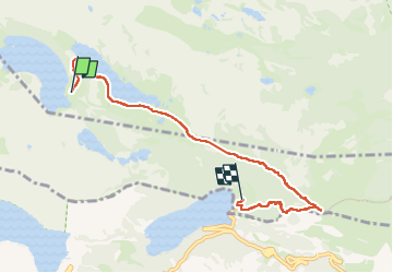
Trail Walking of 6.7 km to be discovered at Occitania, Hautespyrenees, Vielle-Aure. This trail is proposed by jps13.
Description
Superbes passages près des lacs, dernière descente bien raide et fatiguante.
Positioning
Country:
France
Region :
Occitania
Department/Province :
Hautespyrenees
Municipality :
Vielle-Aure
Location:
Unknown
Start:(Dec)
Start:(UTM)
266565 ; 4747064 (31T) N.
Comments