


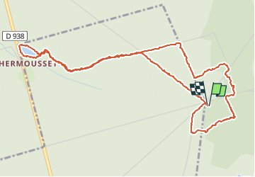
Pierre des Druides et étang de la Herse

martin.mondeville
User

Length
6.4 km

Max alt
258 m

Uphill gradient
107 m
Km-Effort
7.9 km

Min alt
185 m

Downhill gradient
107 m
Boucle
Yes
Creation date :
2024-08-15 11:56:37.0
Updated on :
2024-08-15 13:56:53.481

FREE GPS app for hiking
 SityTrail
IGN / Geographical institutes
SityTrail Plus
The world is yours!
About
Trail of 6.4 km to be discovered at Normandy, Orne, Belforêt-en-Perche. This trail is proposed by martin.mondeville.
Positioning
Country:
France
Region :
Normandy
Department/Province :
Orne
Municipality :
Belforêt-en-Perche
Location:
Sérigny
Start:(Dec)
Start:(UTM)
320359 ; 5363503 (31U) N.
Comments