


Mont Orel - col du Brunel

cron
User
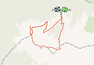

Length
8.9 km

Max alt
2558 m

Uphill gradient
755 m
Km-Effort
18.9 km

Min alt
1906 m

Downhill gradient
757 m
Boucle
Yes
Creation date :
2024-08-16 13:11:40.284
Updated on :
2024-08-16 13:12:16.356
4h18
Difficulty : Medium

FREE GPS app for hiking
 SityTrail
IGN / Geographical institutes
SityTrail Plus
The world is yours!
About
Trail Walking of 8.9 km to be discovered at Provence-Alpes-Côte d'Azur, Hautes-Alpes, Saint-André-d'Embrun. This trail is proposed by cron.
Positioning
Country:
France
Region :
Provence-Alpes-Côte d'Azur
Department/Province :
Hautes-Alpes
Municipality :
Saint-André-d'Embrun
Location:
Unknown
Start:(Dec)
Start:(UTM)
309233 ; 4939547 (32T) N.
Comments