


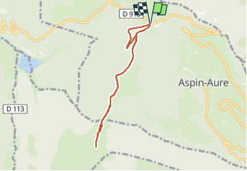
Col d’Aspin

jps13
User

Length
7 km

Max alt
1742 m

Uphill gradient
317 m
Km-Effort
11.2 km

Min alt
1485 m

Downhill gradient
316 m
Boucle
Yes
Creation date :
2024-08-16 10:50:40.0
Updated on :
2024-08-16 13:52:37.059
1h56
Difficulty : Unknown

FREE GPS app for hiking
 SityTrail
IGN / Geographical institutes
SityTrail Plus
The world is yours!
About
Trail Walking of 7 km to be discovered at Occitania, Hautespyrenees, Aspin-Aure. This trail is proposed by jps13.
Description
Tranquille A/R sauf la partie haute plus pentue mais sans difficulté. Superbe vue depuis le sommet.
Positioning
Country:
France
Region :
Occitania
Department/Province :
Hautespyrenees
Municipality :
Aspin-Aure
Location:
Unknown
Start:(Dec)
Start:(UTM)
281931 ; 4757859 (31T) N.
Comments