


PR du tour du Bonjon

Jean Yves Erard
User
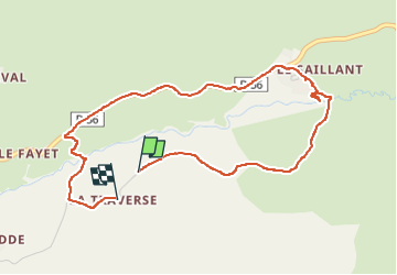

Length
4.7 km

Max alt
1190 m

Uphill gradient
123 m
Km-Effort
6.3 km

Min alt
1075 m

Downhill gradient
121 m
Boucle
No
Creation date :
2024-08-16 14:17:19.035
Updated on :
2024-08-16 15:58:23.386
1h40
Difficulty : Medium

FREE GPS app for hiking
 SityTrail
IGN / Geographical institutes
SityTrail Plus
The world is yours!
About
Trail Walking of 4.7 km to be discovered at Auvergne-Rhône-Alpes, Cantal, Marcenat. This trail is proposed by Jean Yves Erard.
Description
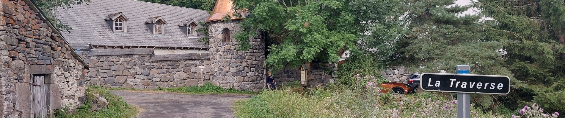
joli petite balade à côté du monastère orthodoxe de Zamenie
Photos


Positioning
Country:
France
Region :
Auvergne-Rhône-Alpes
Department/Province :
Cantal
Municipality :
Marcenat
Location:
Unknown
Start:(Dec)
Start:(UTM)
491907 ; 5019375 (31T) N.
Comments