


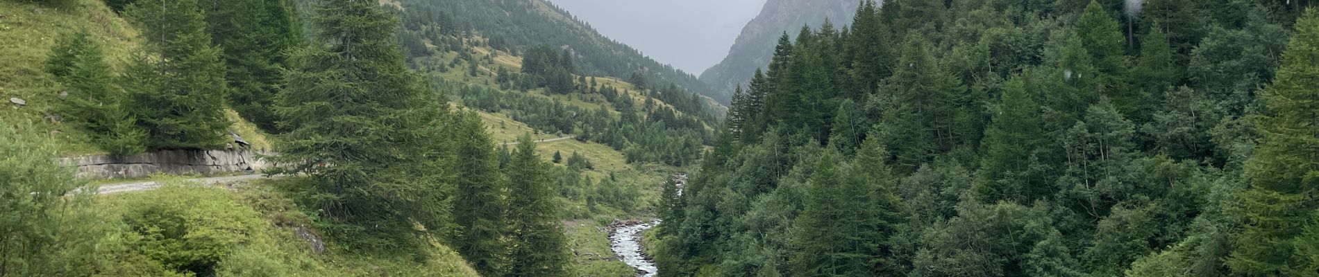
Belvédère Viso

edevuyst
User
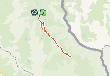

Length
10.8 km

Max alt
2149 m

Uphill gradient
378 m
Km-Effort
15.8 km

Min alt
1776 m

Downhill gradient
381 m
Boucle
Yes
Creation date :
2024-08-16 09:44:25.0
Updated on :
2024-08-16 17:59:45.198
2h10
Difficulty : Difficult

FREE GPS app for hiking
 SityTrail
IGN / Geographical institutes
SityTrail Plus
The world is yours!
About
Trail Walking of 10.8 km to be discovered at Provence-Alpes-Côte d'Azur, Hautes-Alpes, Abriès-Ristolas. This trail is proposed by edevuyst.
Photos


Positioning
Country:
France
Region :
Provence-Alpes-Côte d'Azur
Department/Province :
Hautes-Alpes
Municipality :
Abriès-Ristolas
Location:
Ristolas
Start:(Dec)
Start:(UTM)
341283 ; 4955937 (32T) N.
Comments