


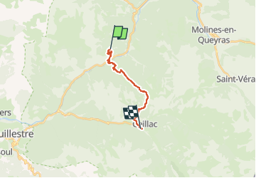
Les Escoyères Ceillac

ARVIEU
User

Length
12.2 km

Max alt
2249 m

Uphill gradient
1081 m
Km-Effort
26 km

Min alt
1188 m

Downhill gradient
985 m
Boucle
No
Creation date :
2024-08-17 16:33:46.497
Updated on :
2024-08-17 16:34:47.922
5h45
Difficulty : Difficult

FREE GPS app for hiking
 SityTrail
IGN / Geographical institutes
SityTrail Plus
The world is yours!
About
Trail Walking of 12.2 km to be discovered at Provence-Alpes-Côte d'Azur, Hautes-Alpes, Arvieux. This trail is proposed by ARVIEU.
Positioning
Country:
France
Region :
Provence-Alpes-Côte d'Azur
Department/Province :
Hautes-Alpes
Municipality :
Arvieux
Location:
Unknown
Start:(Dec)
Start:(UTM)
321388 ; 4954324 (32T) N.
Comments