


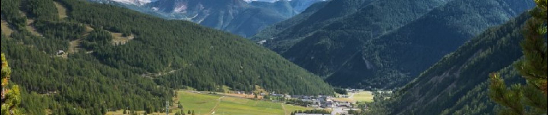
Les Font de Cervières - Arvieux

ARVIEU
User

Length
16.9 km

Max alt
2633 m

Uphill gradient
692 m
Km-Effort
28 km

Min alt
1549 m

Downhill gradient
1194 m
Boucle
No
Creation date :
2024-08-17 17:17:43.185
Updated on :
2024-08-21 09:54:08.551
7h30
Difficulty : Difficult

FREE GPS app for hiking
 SityTrail
IGN / Geographical institutes
SityTrail Plus
The world is yours!
About
Trail Walking of 16.9 km to be discovered at Provence-Alpes-Côte d'Azur, Hautes-Alpes, Cervières. This trail is proposed by ARVIEU.
Photos

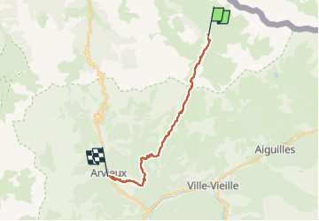
Positioning
Country:
France
Region :
Provence-Alpes-Côte d'Azur
Department/Province :
Hautes-Alpes
Municipality :
Cervières
Location:
Unknown
Start:(Dec)
Start:(UTM)
327483 ; 4968000 (32T) N.
Comments