


Superbagnere cabane esquierry

georghinio
User
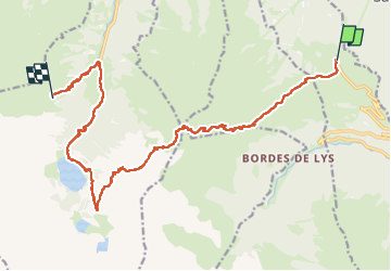

Length
19.7 km

Max alt
2272 m

Uphill gradient
1371 m
Km-Effort
38 km

Min alt
1119 m

Downhill gradient
1510 m
Boucle
No
Creation date :
2024-08-17 06:27:22.0
Updated on :
2024-08-18 08:18:34.295

FREE GPS app for hiking
 SityTrail
IGN / Geographical institutes
SityTrail Plus
The world is yours!
About
Trail of 19.7 km to be discovered at Occitania, Haute-Garonne, Saint-Aventin. This trail is proposed by georghinio.
Positioning
Country:
France
Region :
Occitania
Department/Province :
Haute-Garonne
Municipality :
Saint-Aventin
Location:
Unknown
Start:(Dec)
Start:(UTM)
301709 ; 4737828 (31T) N.
Comments