


SityTrail - 3632225 - le-tour-des-trois-barrages

affinetataille
User GUIDE
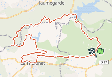

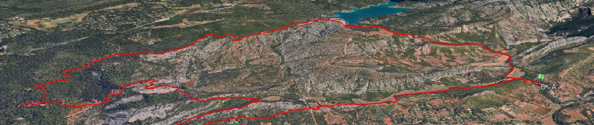
Length
16.1 km

Max alt
384 m

Uphill gradient
495 m
Km-Effort
23 km

Min alt
180 m

Downhill gradient
495 m
Boucle
Yes
Creation date :
2024-08-18 11:07:54.249
Updated on :
2024-10-11 07:58:51.205
7h00
Difficulty : Medium

FREE GPS app for hiking
 SityTrail
IGN / Geographical institutes
SityTrail Plus
The world is yours!
About
Trail Walking of 16.1 km to be discovered at Provence-Alpes-Côte d'Azur, Bouches-du-Rhône, Beaurecueil. This trail is proposed by affinetataille.
Photos


31 photos in total. Please click on a photo to see them all in the gallery.
Positioning
Country:
France
Region :
Provence-Alpes-Côte d'Azur
Department/Province :
Bouches-du-Rhône
Municipality :
Beaurecueil
Location:
Unknown
Start:(Dec)
Start:(UTM)
705858 ; 4822141 (31T) N.
Comments