


camares orient

pcabot
User
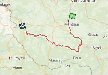

Length
46 km

Max alt
724 m

Uphill gradient
850 m
Km-Effort
57 km

Min alt
332 m

Downhill gradient
850 m
Boucle
No
Creation date :
2024-08-19 14:44:03.664
Updated on :
2024-08-19 17:21:15.18
2h36
Difficulty : Medium

FREE GPS app for hiking
 SityTrail
IGN / Geographical institutes
SityTrail Plus
The world is yours!
About
Trail Mountain bike of 46 km to be discovered at Occitania, Aveyron, Montlaur. This trail is proposed by pcabot.
Positioning
Country:
France
Region :
Occitania
Department/Province :
Aveyron
Municipality :
Montlaur
Location:
Unknown
Start:(Dec)
Start:(UTM)
485333 ; 4858970 (31T) N.
Comments