


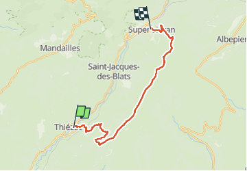
Gr4000 super Lioran

taguette
User

Length
23 km

Max alt
1839 m

Uphill gradient
1277 m
Km-Effort
38 km

Min alt
764 m

Downhill gradient
806 m
Boucle
No
Creation date :
2024-08-23 06:25:14.18
Updated on :
2024-08-23 16:15:37.302
9h49
Difficulty : Very difficult

FREE GPS app for hiking
 SityTrail
IGN / Geographical institutes
SityTrail Plus
The world is yours!
About
Trail Walking of 23 km to be discovered at Auvergne-Rhône-Alpes, Cantal, Thiézac. This trail is proposed by taguette.
Positioning
Country:
France
Region :
Auvergne-Rhône-Alpes
Department/Province :
Cantal
Municipality :
Thiézac
Location:
Unknown
Start:(Dec)
Start:(UTM)
474038 ; 4984478 (31T) N.
Comments