


gtj j17

yvesconnes
User
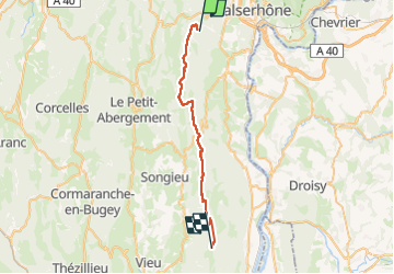

Length
30 km

Max alt
1488 m

Uphill gradient
1113 m
Km-Effort
43 km

Min alt
967 m

Downhill gradient
788 m
Boucle
No
Creation date :
2024-08-24 06:28:35.143
Updated on :
2024-08-24 15:09:43.101
6h02
Difficulty : Very difficult

FREE GPS app for hiking
 SityTrail
IGN / Geographical institutes
SityTrail Plus
The world is yours!
About
Trail Walking of 30 km to be discovered at Auvergne-Rhône-Alpes, Ain, Villes. This trail is proposed by yvesconnes.
Positioning
Country:
France
Region :
Auvergne-Rhône-Alpes
Department/Province :
Ain
Municipality :
Villes
Location:
Unknown
Start:(Dec)
Start:(UTM)
712334 ; 5108921 (31T) N.
Comments