


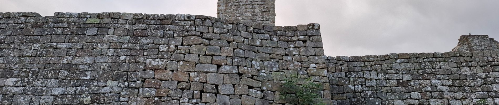
GORGES DU CHASSEZAC DEPUIS LA GARDE- GUERIN

walrou63
User
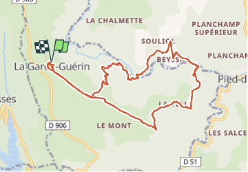

Length
12.1 km

Max alt
874 m

Uphill gradient
584 m
Km-Effort
19.9 km

Min alt
368 m

Downhill gradient
584 m
Boucle
Yes
Creation date :
2024-08-24 06:31:10.119
Updated on :
2024-08-24 17:49:33.599
4h15
Difficulty : Very difficult

FREE GPS app for hiking
 SityTrail
IGN / Geographical institutes
SityTrail Plus
The world is yours!
About
Trail Walking of 12.1 km to be discovered at Occitania, Lozère, Prévenchères. This trail is proposed by walrou63.
Photos


67 photos in total. Please click on a photo to see them all in the gallery.
Positioning
Country:
France
Region :
Occitania
Department/Province :
Lozère
Municipality :
Prévenchères
Location:
Unknown
Start:(Dec)
Start:(UTM)
574371 ; 4925438 (31T) N.
Comments