


st Jacques des béats les boissines

marcagif
User
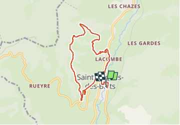

Length
8.3 km

Max alt
1303 m

Uphill gradient
336 m
Km-Effort
12.8 km

Min alt
967 m

Downhill gradient
336 m
Boucle
Yes
Creation date :
2024-08-26 13:57:57.063
Updated on :
2024-08-26 16:11:41.075
2h13
Difficulty : Easy

FREE GPS app for hiking
 SityTrail
IGN / Geographical institutes
SityTrail Plus
The world is yours!
About
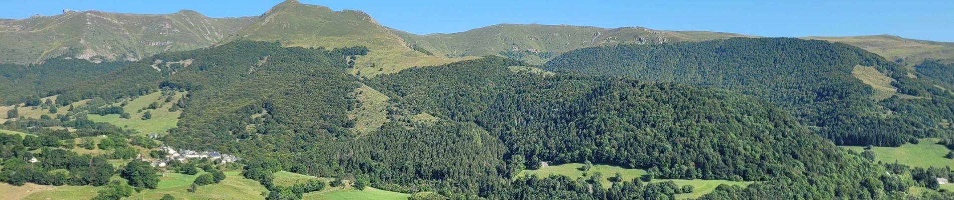
Trail Walking of 8.3 km to be discovered at Auvergne-Rhône-Alpes, Cantal, Saint-Jacques-des-Blats. This trail is proposed by marcagif.
Photos


Positioning
Country:
France
Region :
Auvergne-Rhône-Alpes
Department/Province :
Cantal
Municipality :
Saint-Jacques-des-Blats
Location:
Unknown
Start:(Dec)
Start:(UTM)
477407 ; 4988781 (31T) N.
Comments