


Lacs du Luchonnais

chasle
User

Length
20 km

Max alt
2503 m

Uphill gradient
1488 m
Km-Effort
40 km

Min alt
1126 m

Downhill gradient
1489 m
Boucle
Yes
Creation date :
2024-08-28 04:39:57.27
Updated on :
2024-08-29 06:42:40.72
9h02
Difficulty : Difficult

FREE GPS app for hiking
 SityTrail
IGN / Geographical institutes
SityTrail Plus
The world is yours!
About
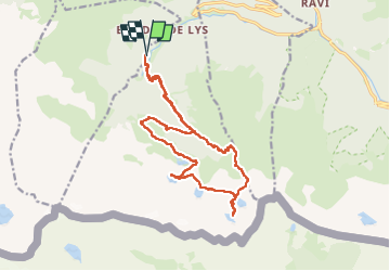
Trail Walking of 20 km to be discovered at Occitania, Haute-Garonne, Castillon-de-Larboust. This trail is proposed by chasle.
Positioning
Country:
France
Region :
Occitania
Department/Province :
Haute-Garonne
Municipality :
Castillon-de-Larboust
Location:
Unknown
Start:(Dec)
Start:(UTM)
299982 ; 4734647 (31T) N.
Comments