


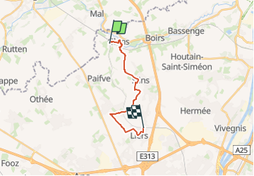
Stationswandeling Glons - Liers

FreddyTuerlinckx
User

Length
12.6 km

Max alt
166 m

Uphill gradient
149 m
Km-Effort
14.3 km

Min alt
79 m

Downhill gradient
70 m
Boucle
No
Creation date :
2024-09-01 07:53:45.861
Updated on :
2024-09-30 05:02:01.298
3h15
Difficulty : Easy

FREE GPS app for hiking
 SityTrail
IGN / Geographical institutes
SityTrail Plus
The world is yours!
About
Trail On foot of 12.6 km to be discovered at Wallonia, Liège, Bassenge. This trail is proposed by FreddyTuerlinckx.
Positioning
Country:
Belgium
Region :
Wallonia
Department/Province :
Liège
Municipality :
Bassenge
Location:
Unknown
Start:(Dec)
Start:(UTM)
678841 ; 5625132 (31U) N.
Comments