


belleydoux fin 240901

ppn
User
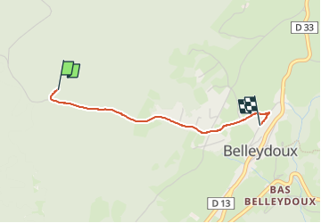

Length
1.9 km

Max alt
960 m

Uphill gradient
1 m
Km-Effort
2.2 km

Min alt
872 m

Downhill gradient
84 m
Boucle
No
Creation date :
2024-09-01 09:56:22.708
Updated on :
2024-09-01 17:55:41.245
30m
Difficulty : Easy

FREE GPS app for hiking
 SityTrail
IGN / Geographical institutes
SityTrail Plus
The world is yours!
About
Trail Walking of 1.9 km to be discovered at Auvergne-Rhône-Alpes, Ain, Belleydoux. This trail is proposed by ppn.
Positioning
Country:
France
Region :
Auvergne-Rhône-Alpes
Department/Province :
Ain
Municipality :
Belleydoux
Location:
Unknown
Start:(Dec)
Start:(UTM)
712577 ; 5126251 (31T) N.
Comments