angles chamate 914m 14kms

Danielba
User GUIDE
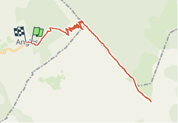

Length
13.7 km

Max alt
1839 m

Uphill gradient
876 m
Km-Effort
25 km

Min alt
970 m

Downhill gradient
897 m
Boucle
Yes
Creation date :
2024-09-01 06:06:50.891
Updated on :
2024-09-01 14:10:30.579
6h17
Difficulty : Medium

FREE GPS app for hiking
 SityTrail
IGN / Geographical institutes
SityTrail Plus
The world is yours!
About
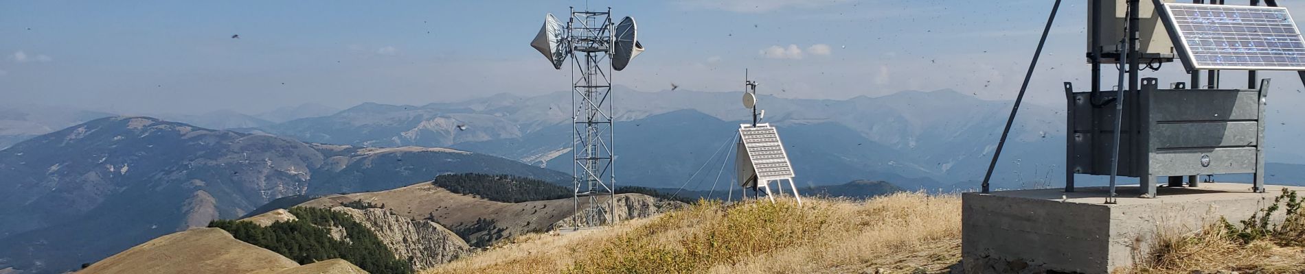
Trail Walking of 13.7 km to be discovered at Provence-Alpes-Côte d'Azur, Alpes-de-Haute-Provence, Angles. This trail is proposed by Danielba .
Photos


Positioning
Country:
France
Region :
Provence-Alpes-Côte d'Azur
Department/Province :
Alpes-de-Haute-Provence
Municipality :
Angles
Location:
Unknown
Start:(Dec)
Start:(UTM)
304181 ; 4868378 (32T) N.
Comments