


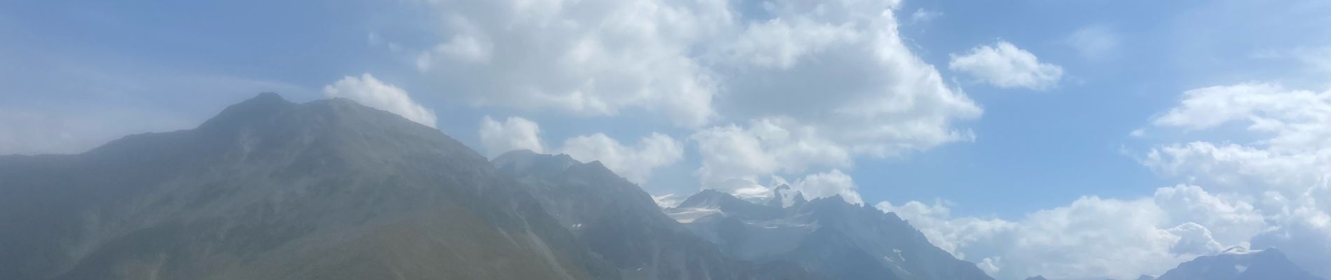
M’ont Brûlé 2

michauxpaul
User
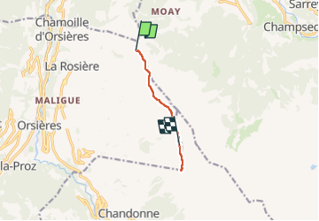

Length
5.6 km

Max alt
2555 m

Uphill gradient
465 m
Km-Effort
10.8 km

Min alt
2144 m

Downhill gradient
168 m
Boucle
No
Creation date :
2024-09-01 09:24:10.0
Updated on :
2024-09-01 18:42:11.636
2h26
Difficulty : Medium

FREE GPS app for hiking
 SityTrail
IGN / Geographical institutes
SityTrail Plus
The world is yours!
About
Trail Walking of 5.6 km to be discovered at Valais/Wallis, Entremont, Orsières. This trail is proposed by michauxpaul.
Description
Trek
Photos

Positioning
Country:
Switzerland
Region :
Valais/Wallis
Department/Province :
Entremont
Municipality :
Orsières
Location:
Unknown
Start:(Dec)
Start:(UTM)
359450 ; 5101263 (32T) N.
Comments