


Pic Foreant

pb07
User
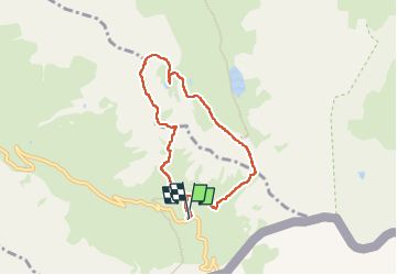

Length
7.1 km

Max alt
3065 m

Uphill gradient
496 m
Km-Effort
13.7 km

Min alt
2629 m

Downhill gradient
494 m
Boucle
Yes
Creation date :
2024-09-03 07:26:23.939
Updated on :
2024-09-03 15:13:21.314
4h30
Difficulty : Difficult

FREE GPS app for hiking
 SityTrail
IGN / Geographical institutes
SityTrail Plus
The world is yours!
About
Trail Walking of 7.1 km to be discovered at Provence-Alpes-Côte d'Azur, Hautes-Alpes, Molines-en-Queyras. This trail is proposed by pb07.
Positioning
Country:
France
Region :
Provence-Alpes-Côte d'Azur
Department/Province :
Hautes-Alpes
Municipality :
Molines-en-Queyras
Location:
Unknown
Start:(Dec)
Start:(UTM)
339620 ; 4950552 (32T) N.
Comments