


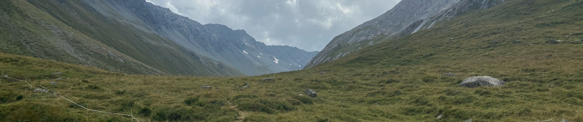
Combe de l’A

michauxpaul
User
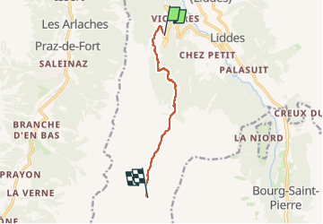

Length
6.8 km

Max alt
2076 m

Uphill gradient
509 m
Km-Effort
12 km

Min alt
1594 m

Downhill gradient
37 m
Boucle
No
Creation date :
2024-09-03 10:33:56.0
Updated on :
2024-09-03 23:41:46.867
3h27
Difficulty : Medium

FREE GPS app for hiking
 SityTrail
IGN / Geographical institutes
SityTrail Plus
The world is yours!
About
Trail Walking of 6.8 km to be discovered at Valais/Wallis, Entremont, Liddes. This trail is proposed by michauxpaul.
Description
Trek
Photos


Positioning
Country:
Switzerland
Region :
Valais/Wallis
Department/Province :
Entremont
Municipality :
Liddes
Location:
Unknown
Start:(Dec)
Start:(UTM)
357671 ; 5094841 (32T) N.
Comments