


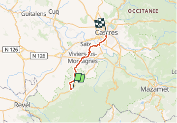
Dourgne - Castres

Alain28/01
User

Length
26 km

Max alt
263 m

Uphill gradient
310 m
Km-Effort
31 km

Min alt
161 m

Downhill gradient
374 m
Boucle
No
Creation date :
2024-09-04 07:06:02.686
Updated on :
2024-09-04 14:04:54.63
4h58
Difficulty : Difficult

FREE GPS app for hiking
 SityTrail
IGN / Geographical institutes
SityTrail Plus
The world is yours!
About
Trail Walking of 26 km to be discovered at Occitania, Tarn, Dourgne. This trail is proposed by Alain28/01.
Description
journée tristounette sous la pluie, beaucoup de route et de macadam.
Positioning
Country:
France
Region :
Occitania
Department/Province :
Tarn
Municipality :
Dourgne
Location:
Unknown
Start:(Dec)
Start:(UTM)
431011 ; 4815743 (31T) N.
Comments