


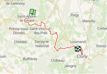
RA Saint André - Cluny Abbaye

dfluzin
User

Length
21 km

Max alt
515 m

Uphill gradient
547 m
Km-Effort
29 km

Min alt
221 m

Downhill gradient
543 m
Boucle
No
Creation date :
2015-05-08 00:00:00.0
Updated on :
2021-10-20 15:41:25.466
6h04
Difficulty : Medium

FREE GPS app for hiking
 SityTrail
IGN / Geographical institutes
SityTrail Plus
The world is yours!
About
Trail Walking of 21 km to be discovered at Bourgogne-Franche-Comté, Saône-et-Loire, Saint-André-le-Désert. This trail is proposed by dfluzin.
Positioning
Country:
France
Region :
Bourgogne-Franche-Comté
Department/Province :
Saône-et-Loire
Municipality :
Saint-André-le-Désert
Location:
Unknown
Start:(Dec)
Start:(UTM)
617681 ; 5150120 (31T) N.
Comments