


Vallée de Chaudefour

bbertrand974
User

Length
3.1 km

Max alt
1214 m

Uphill gradient
80 m
Km-Effort
4.2 km

Min alt
1137 m

Downhill gradient
82 m
Boucle
Yes
Creation date :
2024-09-10 12:08:26.0
Updated on :
2024-09-10 13:35:53.2
1h27
Difficulty : Easy

FREE GPS app for hiking
 SityTrail
IGN / Geographical institutes
SityTrail Plus
The world is yours!
About
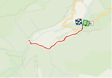
Trail Walking of 3.1 km to be discovered at Auvergne-Rhône-Alpes, Puy-de-Dôme, Chambon-sur-Lac. This trail is proposed by bbertrand974.
Positioning
Country:
France
Region :
Auvergne-Rhône-Alpes
Department/Province :
Puy-de-Dôme
Municipality :
Chambon-sur-Lac
Location:
Unknown
Start:(Dec)
Start:(UTM)
489206 ; 5043001 (31T) N.
Comments