


grotte

darranger
User
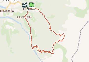

Length
10.9 km

Max alt
1730 m

Uphill gradient
749 m
Km-Effort
21 km

Min alt
968 m

Downhill gradient
750 m
Boucle
Yes
Creation date :
2024-09-11 07:38:22.035
Updated on :
2024-09-11 14:18:16.989
3h48
Difficulty : Very difficult

FREE GPS app for hiking
 SityTrail
IGN / Geographical institutes
SityTrail Plus
The world is yours!
About
Trail Walking of 10.9 km to be discovered at Auvergne-Rhône-Alpes, Isère, Tréminis. This trail is proposed by darranger.
Positioning
Country:
France
Region :
Auvergne-Rhône-Alpes
Department/Province :
Isère
Municipality :
Tréminis
Location:
Unknown
Start:(Dec)
Start:(UTM)
720161 ; 4957980 (31T) N.
Comments