


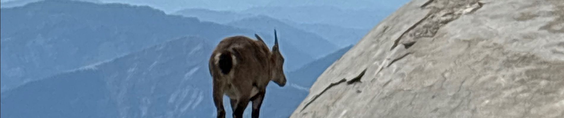
Isola 2000 Mont St Sauveur

GeorgesV.
User
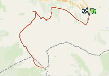

Length
16 km

Max alt
2698 m

Uphill gradient
943 m
Km-Effort
29 km

Min alt
2007 m

Downhill gradient
944 m
Boucle
Yes
Creation date :
2024-09-11 06:52:33.0
Updated on :
2024-09-11 15:09:26.898

FREE GPS app for hiking
 SityTrail
IGN / Geographical institutes
SityTrail Plus
The world is yours!
About
Trail of 16 km to be discovered at Provence-Alpes-Côte d'Azur, Maritime Alps, Isola. This trail is proposed by GeorgesV..
Photos


Positioning
Country:
France
Region :
Provence-Alpes-Côte d'Azur
Department/Province :
Maritime Alps
Municipality :
Isola
Location:
Unknown
Start:(Dec)
Start:(UTM)
352950 ; 4894031 (32T) N.
Comments