


Saint cirq lapopie Bach

simonm0204
User
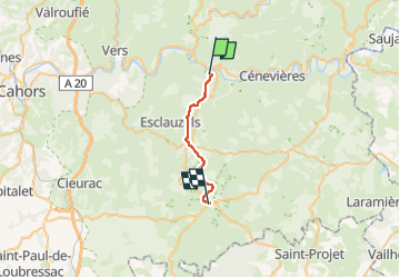

Length
18.9 km

Max alt
380 m

Uphill gradient
427 m
Km-Effort
24 km

Min alt
198 m

Downhill gradient
324 m
Boucle
No
Creation date :
2024-09-12 07:01:40.0
Updated on :
2024-09-12 14:39:56.984

FREE GPS app for hiking
 SityTrail
IGN / Geographical institutes
SityTrail Plus
The world is yours!
About
Trail of 18.9 km to be discovered at Occitania, Lot, Saint-Cirq-Lapopie. This trail is proposed by simonm0204.
Description
A travers les bois , les chenes
Positioning
Country:
France
Region :
Occitania
Department/Province :
Lot
Municipality :
Saint-Cirq-Lapopie
Location:
Unknown
Start:(Dec)
Start:(UTM)
394129 ; 4924345 (31T) N.
Comments