


mouriere

lionelnottat
User
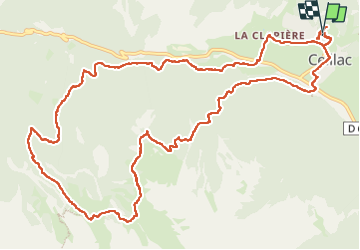

Length
16.5 km

Max alt
2364 m

Uphill gradient
1011 m
Km-Effort
30 km

Min alt
1530 m

Downhill gradient
996 m
Boucle
Yes
Creation date :
2024-09-12 07:03:23.041
Updated on :
2024-09-12 15:49:26.829
5h30
Difficulty : Very difficult

FREE GPS app for hiking
 SityTrail
IGN / Geographical institutes
SityTrail Plus
The world is yours!
About
Trail Walking of 16.5 km to be discovered at Provence-Alpes-Côte d'Azur, Hautes-Alpes, Ceillac. This trail is proposed by lionelnottat.
Positioning
Country:
France
Region :
Provence-Alpes-Côte d'Azur
Department/Province :
Hautes-Alpes
Municipality :
Ceillac
Location:
Unknown
Start:(Dec)
Start:(UTM)
323771 ; 4948843 (32T) N.
Comments