


ArreauG4

LouisROGER
User GUIDE

Length
8.9 km

Max alt
875 m

Uphill gradient
231 m
Km-Effort
11.9 km

Min alt
676 m

Downhill gradient
232 m
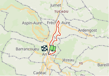
Boucle
Yes
Creation date :
2024-09-13 07:50:16.385
Updated on :
2024-09-13 12:51:38.775
5h00
Difficulty : Medium

FREE GPS app for hiking
 SityTrail
IGN / Geographical institutes
SityTrail Plus
The world is yours!
About
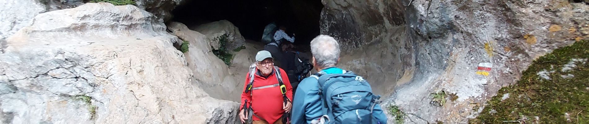
Trail Walking of 8.9 km to be discovered at Occitania, Hautespyrenees, Arreau. This trail is proposed by LouisROGER.
Photos

Positioning
Country:
France
Region :
Occitania
Department/Province :
Hautespyrenees
Municipality :
Arreau
Location:
Unknown
Start:(Dec)
Start:(UTM)
284440 ; 4753593 (31T) N.
Comments