Trail Walking Marmoutier - Circuit du Tannenwald - Photo

Circuit du Tannenwald

© OpenStreetMap contributors
Length
Length
15.4 km
Max alt
Max alt
368 m
Uphill gradient
Uphill gradient
339 m
Km-Effort
Km-Effort  
19.9 km
Min alt
Min alt
218 m
Downhill gradient
Downhill gradient
339 m
Boucle
Boucle
Yes
Creation date :
2015-05-10 00:00:00.0
Updated on :
2015-05-10 00:00:00.0

(1 Reviews)

Walking
Walking
4h14
Difficulty : Medium

Scan this QR Code to open this trail in the SityTrail application

FREE GPS app for hiking

Logo SityTrail SityTrail

IGN / Geographical institutes

Download SityTrail from the App Store Download SityTrail from Google Play

Logo SityTrail SityTrail World

The world is yours!

Download SityTrail from the App Store Download SityTrail from Google Play Download SityTrail on Huawei AppGallery

About

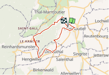
Trail Walking of 15.4 km to be discovered at Grand Est, Bas-Rhin, Marmoutier. This trail is proposed by VacheKiri67.

Description

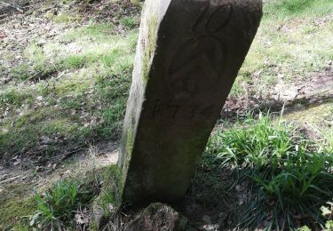
Faite le 10/05/2015 avec notre fils de 10 ans. Circuit du Tannenwald : balisage anneau bleu. Départ rue de la gare à Marmoutier. La durée indiquée pour le circuit est de 4h00 pour 13km.

Elevation profile

Photos

Positioning

Country:
France
Region :
Grand Est
Department/Province :
Bas-Rhin
Municipality :
Marmoutier
Location:
Unknown
Start:(UTM)
380339 ; 5394405 (32U) N.

Comments

Please log in to post a review or rate the element


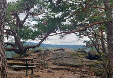
Un parcours qui ne paie pas de mine ! Et pourtant la variété est au rendez-vous : prairies, vergers, forêts, belles vues... Ne pas oublier d'aller visiter l'abbatiale au centre de Marmoutier.


Trails nearby

Trail Walking Reinhardsmunster - 2021-09-01 Marche Reinhardsmunster Haut Barr - Photo
Walking
GUIDE
holtzv

Walking

Very difficult
Reinhardsmunster, Grand Est, Bas-Rhin, France
21 km | 32 km-effort
6h 39min
Yes
Trail Walking Reinhardsmunster - 2019-08-15 Marche Schaerferplatz Geissfels Ochsenstein - Photo
Walking
GUIDE
holtzv

Walking

Very difficult
Reinhardsmunster, Grand Est, Bas-Rhin, France
15 km | 23 km-effort
4h 49min
Yes
Trail Walking Haegen - Haut Barr-Obersteigen-Haut Barr - Photo
Walking
edouard_bieber

Walking

Medium
(2)
Haegen, Grand Est, Bas-Rhin, France
27 km | 40 km-effort
6h 7min
Yes
Trail Walking Marmoutier - Marmoutier - Salenthal - Singrist- Kopp - couvent de Reinacker - Photo
Walking
Jean-Pascal Sap

Walking

Medium
Marmoutier, Grand Est, Bas-Rhin, France
16.2 km | 21 km-effort
4h 16min
No
Trail Walking Reinhardsmunster - table des Géants  - Photo
Walking
apa

Walking

Easy
(1)
Reinhardsmunster, Grand Est, Bas-Rhin, France
10.4 km | 14.7 km-effort
3h 6min
Yes
Trail Walking Sommerau - Birkenwald Heidenschloss - Photo
Walking
apa

Walking

Medium
Sommerau, Grand Est, Bas-Rhin, France
12.8 km | 18.1 km-effort
3h 26min
Yes
Trail On foot Dimbsthal - Circuit de découverte du Tannenwald - Photo
On foot
PRO

On foot

Easy
Dimbsthal, Grand Est, Bas-Rhin, France
4.9 km | 6.3 km-effort
1h 26min
No
Trail Walking Reinhardsmunster - Rheinhardsmunster - Photo
Walking
Marie-Claude Martin

Walking

Difficult
Reinhardsmunster, Grand Est, Bas-Rhin, France
22 km | 31 km-effort
6h 42min
Yes
Trail Horseback riding Saverne - 2018-04-15 CRTE Alsace Geroldseck Haut Barr - Photo
Horseback riding
GUIDE+

Horseback riding

Medium
Saverne, Grand Est, Bas-Rhin, France
18.9 km | 27 km-effort
3h 14min
Yes


Close
My subscriptions