


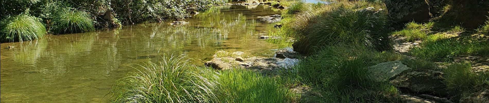
Sommières les moulins du Vidourle

BERNADETTE MONEY
User

Length
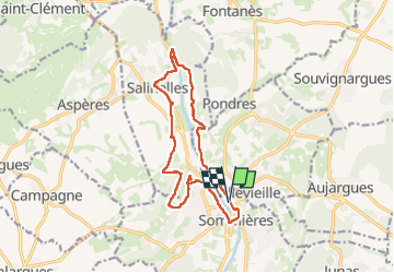
15.1 km

Max alt
96 m

Uphill gradient
181 m
Km-Effort
17.5 km

Min alt
24 m

Downhill gradient
182 m
Boucle
Yes
Creation date :
2024-09-15 07:44:00.152
Updated on :
2024-09-15 13:58:26.965
4h12
Difficulty : Very easy

FREE GPS app for hiking
 SityTrail
IGN / Geographical institutes
SityTrail Plus
The world is yours!
About
Trail Walking of 15.1 km to be discovered at Occitania, Gard, Sommières. This trail is proposed by BERNADETTE MONEY.
Photos


Positioning
Country:
France
Region :
Occitania
Department/Province :
Gard
Municipality :
Sommières
Location:
Unknown
Start:(Dec)
Start:(UTM)
587484 ; 4848730 (31T) N.
Comments