


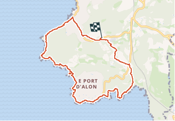
Port d'Alon-Madrague

cousam
User

Length
10.8 km

Max alt
100 m

Uphill gradient
279 m
Km-Effort
14.5 km

Min alt
0 m

Downhill gradient
276 m
Boucle
Yes
Creation date :
2024-09-15 08:14:22.694
Updated on :
2024-09-15 15:55:37.463
5h47
Difficulty : Medium

FREE GPS app for hiking
 SityTrail
IGN / Geographical institutes
SityTrail Plus
The world is yours!
About
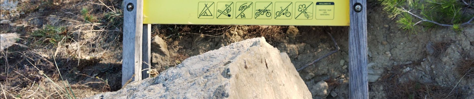
Trail Walking of 10.8 km to be discovered at Provence-Alpes-Côte d'Azur, Var, Saint-Cyr-sur-Mer. This trail is proposed by cousam.
Photos


Positioning
Country:
France
Region :
Provence-Alpes-Côte d'Azur
Department/Province :
Var
Municipality :
Saint-Cyr-sur-Mer
Location:
Unknown
Start:(Dec)
Start:(UTM)
719859 ; 4782186 (31T) N.
Comments