


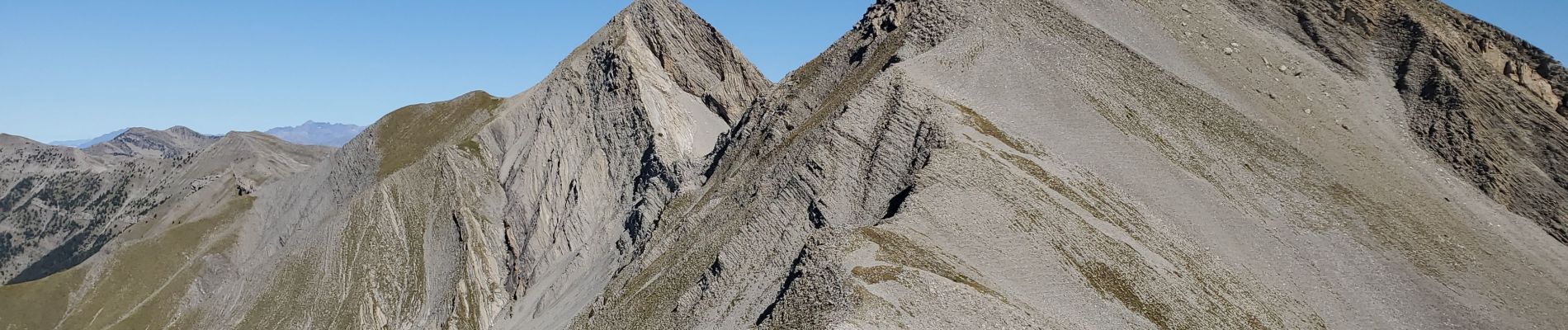
dos de chameau 1165m 12kms

Danielba
User GUIDE
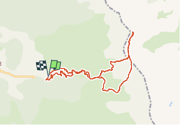

Length
10.8 km

Max alt
2582 m

Uphill gradient
1112 m
Km-Effort
26 km

Min alt
1516 m

Downhill gradient
1113 m
Boucle
Yes
Creation date :
2024-09-15 06:26:29.439
Updated on :
2024-09-15 16:34:26.067
8h05
Difficulty : Medium

FREE GPS app for hiking
 SityTrail
IGN / Geographical institutes
SityTrail Plus
The world is yours!
About
Trail Walking of 10.8 km to be discovered at Provence-Alpes-Côte d'Azur, Alpes-de-Haute-Provence, Seyne. This trail is proposed by Danielba .
Photos


Positioning
Country:
France
Region :
Provence-Alpes-Côte d'Azur
Department/Province :
Alpes-de-Haute-Provence
Municipality :
Seyne
Location:
Unknown
Start:(Dec)
Start:(UTM)
294864 ; 4910584 (32T) N.
Comments