


Les Vignes

fanthou
User
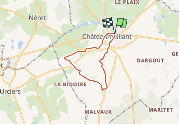

Length
9.9 km

Max alt
305 m

Uphill gradient
120 m
Km-Effort
11.5 km

Min alt
234 m

Downhill gradient
122 m
Boucle
Yes
Creation date :
2024-09-16 15:56:53.446
Updated on :
2024-09-16 15:57:19.291
2h36
Difficulty : Medium

FREE GPS app for hiking
 SityTrail
IGN / Geographical institutes
SityTrail Plus
The world is yours!
About
Trail Walking of 9.9 km to be discovered at Centre-Loire Valley, Cher, Châteaumeillant. This trail is proposed by fanthou.
Positioning
Country:
France
Region :
Centre-Loire Valley
Department/Province :
Cher
Municipality :
Châteaumeillant
Location:
Unknown
Start:(Dec)
Start:(UTM)
438838 ; 5156794 (31T) N.
Comments