


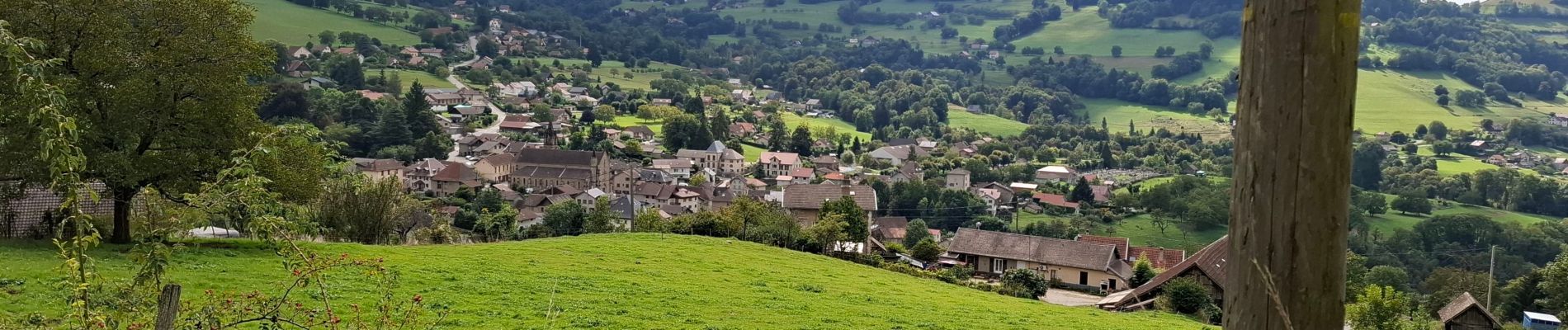
TOUR DE LA VILLETTE PAR LE PLAN DE LA MALADE

walrou63
User
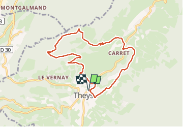

Length
9.1 km

Max alt
1094 m

Uphill gradient
480 m
Km-Effort
15.5 km

Min alt
637 m

Downhill gradient
479 m
Boucle
Yes
Creation date :
2024-09-17 12:17:37.381
Updated on :
2024-09-18 07:57:18.415
2h30
Difficulty : Difficult

FREE GPS app for hiking
 SityTrail
IGN / Geographical institutes
SityTrail Plus
The world is yours!
About
Trail Walking of 9.1 km to be discovered at Auvergne-Rhône-Alpes, Isère, Theys. This trail is proposed by walrou63.
Photos


Positioning
Country:
France
Region :
Auvergne-Rhône-Alpes
Department/Province :
Isère
Municipality :
Theys
Location:
Unknown
Start:(Dec)
Start:(UTM)
735001 ; 5020939 (31T) N.
Comments