


lac Arrouy

chasle
User
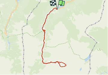

Length
23 km

Max alt
2392 m

Uphill gradient
1318 m
Km-Effort
40 km

Min alt
1161 m

Downhill gradient
1318 m
Boucle
Yes
Creation date :
2024-09-18 05:59:35.267
Updated on :
2024-09-18 17:11:49.238
9h12
Difficulty : Difficult

FREE GPS app for hiking
 SityTrail
IGN / Geographical institutes
SityTrail Plus
The world is yours!
About
Trail Walking of 23 km to be discovered at Occitania, Hautespyrenees, Estaing. This trail is proposed by chasle.
Positioning
Country:
France
Region :
Occitania
Department/Province :
Hautespyrenees
Municipality :
Estaing
Location:
Unknown
Start:(Dec)
Start:(UTM)
727621 ; 4753950 (30T) N.
Comments