


20240919 Bisceglie

Childebert
User
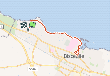

Length
9.5 km

Max alt
28 m

Uphill gradient
102 m
Km-Effort
10.8 km

Min alt
0 m

Downhill gradient
102 m
Boucle
Yes
Creation date :
2024-09-19 08:33:03.014
Updated on :
2024-09-19 12:55:12.538
4h21
Difficulty : Easy

FREE GPS app for hiking
 SityTrail
IGN / Geographical institutes
SityTrail Plus
The world is yours!
About
Trail Walking of 9.5 km to be discovered at Apulia, Barletta-Andria-Trani, Bisceglie. This trail is proposed by Childebert.
Photos

Positioning
Country:
Italy
Region :
Apulia
Department/Province :
Barletta-Andria-Trani
Municipality :
Bisceglie
Location:
Unknown
Start:(Dec)
Start:(UTM)
623618 ; 4567643 (33T) N.
Comments