


PETITE RANDONNEE AU DEPART DU PONT DE LA BETTA

walrou63
User

Length
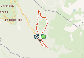
6.1 km

Max alt
1555 m

Uphill gradient
281 m
Km-Effort
9.9 km

Min alt
1264 m

Downhill gradient
290 m
Boucle
Yes
Creation date :
2024-09-19 13:13:53.149
Updated on :
2024-09-20 09:06:52.341
1h35
Difficulty : Medium

FREE GPS app for hiking
 SityTrail
IGN / Geographical institutes
SityTrail Plus
The world is yours!
About
Trail Walking of 6.1 km to be discovered at Auvergne-Rhône-Alpes, Isère, Laval-en-Belledonne. This trail is proposed by walrou63.
Description
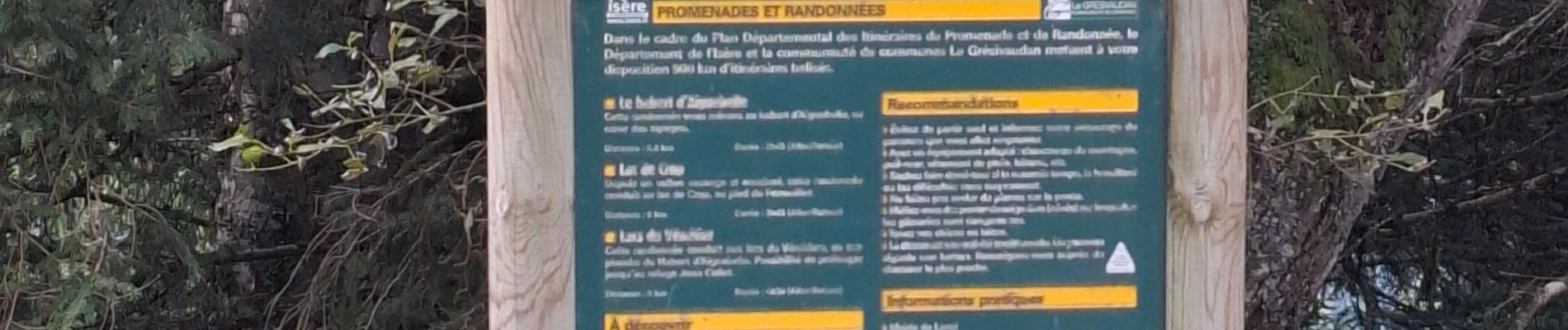
Départ du parking du pont de la Betta en direction de la colonie du Pré de l' Arc.
Photos


25 photos in total. Please click on a photo to see them all in the gallery.
Positioning
Country:
France
Region :
Auvergne-Rhône-Alpes
Department/Province :
Isère
Municipality :
Laval-en-Belledonne
Location:
Unknown
Start:(Dec)
Start:(UTM)
735016 ; 5012559 (31T) N.
Comments