Trail Walking Le Dévoluy - 
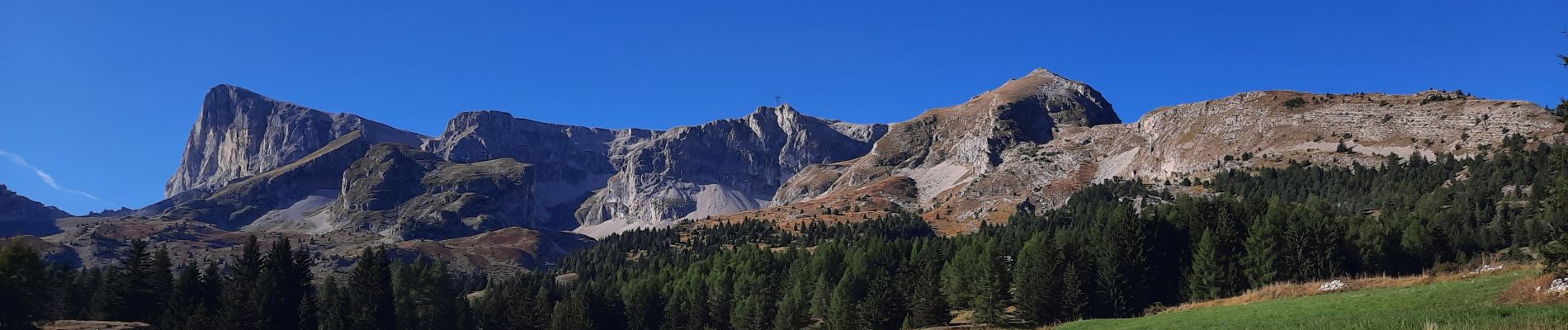
Vallons de la Corne et d'Ane  - Photo
© OpenStreetMap contributors
Length
Length
13.4 km
Max alt
Max alt
2047 m
Uphill gradient
Uphill gradient
795 m
Km-Effort
Km-Effort  
24 km
Min alt
Min alt
1475 m
Downhill gradient
Downhill gradient
796 m
Boucle
Boucle
Yes
Creation date :
2024-09-19 07:33:22.183
Updated on :
2024-09-25 13:54:25.156

(0 Reviews)

Walking
Walking
6h39
Difficulty : Very difficult

Scan this QR Code to open this trail in the SityTrail application

FREE GPS app for hiking

Logo SityTrail SityTrail

IGN / Geographical institutes

Download SityTrail from the App Store Download SityTrail from Google Play

Logo SityTrail SityTrail Plus

The world is yours!

Download SityTrail from the App Store Download SityTrail from Google Play Download SityTrail on Huawei AppGallery

About

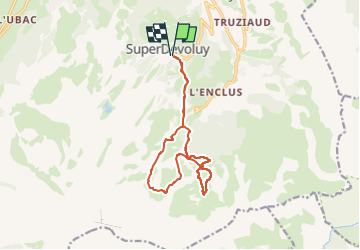
Trail Walking of 13.4 km to be discovered at Provence-Alpes-Côte d'Azur, Hautes-Alpes, Le Dévoluy. This trail is proposed by GuyVachet.

Description

Tour de ces deux très beaux vallons parcourus ici à l'Automne pour profiter des magnifiques couleurs de fin de saison. Itinéraire avec régulièrement le Pic de Bure en point de mire. Le premier vallon se mérite tant à la montée et qu'à la descente tandis que le second se fait plus doux pour bien terminer la journée ;-)

Elevation profile

Photos

Positioning

Country:
France
Region :
Provence-Alpes-Côte d'Azur
Department/Province :
Hautes-Alpes
Municipality :
Le Dévoluy
Location:
Saint-Étienne-en-Dévoluy
Start:(UTM)
732320 ; 4951009 (31T) N.


Close
My subscriptions