


rando des crêtes Coti Chjavari

Maca8284
User
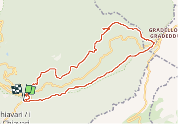

Length
11.4 km

Max alt
605 m

Uphill gradient
303 m
Km-Effort
15.5 km

Min alt
373 m

Downhill gradient
307 m
Boucle
Yes
Creation date :
2024-09-19 12:37:59.41
Updated on :
2024-09-20 06:59:43.848
3h08
Difficulty : Difficult

FREE GPS app for hiking
 SityTrail
IGN / Geographical institutes
SityTrail Plus
The world is yours!
About
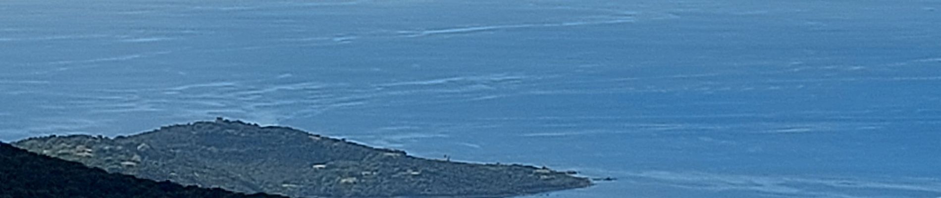
Trail Walking of 11.4 km to be discovered at Corsica, South Corsica, Coti-Chiavari. This trail is proposed by Maca8284.
Photos


Positioning
Country:
France
Region :
Corsica
Department/Province :
South Corsica
Municipality :
Coti-Chiavari
Location:
Unknown
Start:(Dec)
Start:(UTM)
481522 ; 4625127 (32T) N.
Comments