


2024-10-01-Davron

Rando MLC
User
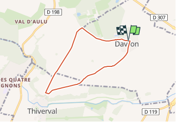

Length
6 km

Max alt
127 m

Uphill gradient
49 m
Km-Effort
6.7 km

Min alt
100 m

Downhill gradient
48 m
Boucle
Yes
Creation date :
2024-09-20 16:34:28.21
Updated on :
2024-10-02 07:29:15.485
1h31
Difficulty : Medium

FREE GPS app for hiking
 SityTrail
IGN / Geographical institutes
SityTrail Plus
The world is yours!
About
Trail Walking of 6 km to be discovered at Ile-de-France, Yvelines, Davron. This trail is proposed by Rando MLC.
Positioning
Country:
France
Region :
Ile-de-France
Department/Province :
Yvelines
Municipality :
Davron
Location:
Unknown
Start:(Dec)
Start:(UTM)
422788 ; 5413072 (31U) N.
Comments