Trail Walking Sainte-Anastasie-sur-Issole - Circuits des sources - Photo
 frizou83
frizou83

User

© OpenStreetMap contributors
Length
Length
15.1 km
Max alt
Max alt
535 m
Uphill gradient
Uphill gradient
541 m
Km-Effort
Km-Effort  
22 km
Min alt
Min alt
276 m
Downhill gradient
Downhill gradient
541 m
Boucle
Boucle
Yes
Creation date :
2015-05-11 00:00:00.0
Updated on :
2015-05-11 00:00:00.0

(0 Reviews)

Walking
Walking
4h44
Difficulty : Medium

Scan this QR Code to open this trail in the SityTrail application

FREE GPS app for hiking

Logo SityTrail SityTrail

IGN / Geographical institutes

Download SityTrail from the App Store Download SityTrail from Google Play

Logo SityTrail SityTrail Plus

The world is yours!

Download SityTrail from the App Store Download SityTrail from Google Play Download SityTrail on Huawei AppGallery

About

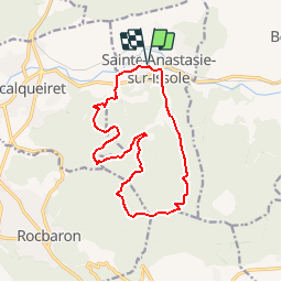
Trail Walking of 15.1 km to be discovered at Provence-Alpes-Côte d'Azur, Var, Sainte-Anastasie-sur-Issole. This trail is proposed by frizou83.

Description

Randonnées passant par la grotte de la Barouquine, la source de Bourboutéou et le puits de Sauzède

Elevation profile

Points of interest

Point of interest Rocbaron - Puits de Sauzède - Photo
frizou83
Point of interest Forcalqueiret - Grotte de la Barouquine - Photo
frizou83
Point of interest Sainte-Anastasie-sur-Issole - Source de Bourboutéou - Photo
frizou83
SAINTE-ANASTASIE-SUR-ISSOLE 
Point of interest Rocbaron - Eboulis - Photo
frizou83
ROCBARON 
Point of interest Rocbaron - Anciennes bories - Photo
frizou83
Point of interest Sainte-Anastasie-sur-Issole - Plate-forme - Photo
frizou83
SAINTE-ANASTASIE-SUR-ISSOLE 
Point of interest Sainte-Anastasie-sur-Issole - Grotte - Photo
frizou83
SAINTE-ANASTASIE-SUR-ISSOLE 

Positioning

Country:
France
Region :
Provence-Alpes-Côte d'Azur
Department/Province :
Var
Municipality :
Sainte-Anastasie-sur-Issole
Location:
Unknown
Start:(UTM)
266725 ; 4802909 (32T) N.


Close
My subscriptions