Trail Walking Saint-Pierre-lès-Nemours - foret domaniale de la commanderie/ larchant - Photo

foret domaniale de la commanderie/ larchant

 meillon
meillon

User

© OpenStreetMap contributors
Length
Length
25 km
Max alt
Max alt
123 m
Uphill gradient
Uphill gradient
371 m
Km-Effort
Km-Effort  
30 km
Min alt
Min alt
58 m
Downhill gradient
Downhill gradient
358 m
Boucle
Boucle
No
Creation date :
2015-05-12 00:00:00.0
Updated on :
2015-05-12 00:00:00.0

(0 Reviews)

Walking
Walking
6h32
Difficulty : Difficult

Scan this QR Code to open this trail in the SityTrail application

FREE GPS app for hiking

Logo SityTrail SityTrail

IGN / Geographical institutes

Download SityTrail from the App Store Download SityTrail from Google Play

Logo SityTrail SityTrail World

The world is yours!

Download SityTrail from the App Store Download SityTrail from Google Play Download SityTrail on Huawei AppGallery

About

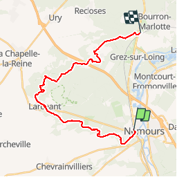
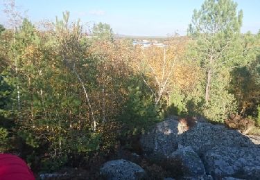
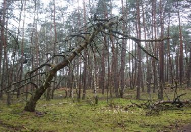
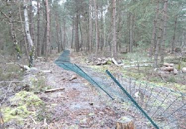
Trail Walking of 25 km to be discovered at Ile-de-France, Seine-et-Marne, Saint-Pierre-lès-Nemours. This trail is proposed by meillon.

Description

dynamique

Elevation profile

Positioning

Country:
France
Region :
Ile-de-France
Department/Province :
Seine-et-Marne
Municipality :
Saint-Pierre-lès-Nemours
Location:
Unknown
Start:(UTM)
476619 ; 5346211 (31U) N.

Trails nearby

Trail Walking Saint-Pierre-lès-Nemours - Rochers Gréau et Puiselet - Photo
Walking
Philippepauleau

Walking

Medium
(1)
Saint-Pierre-lès-Nemours, Ile-de-France, Seine-et-Marne, France
10.8 km | 13.2 km-effort
2h 41min
Yes
Trail On foot La Genevraye - Du canal du Loing au berges du Lunain - Photo
On foot
PRO

On foot

Easy
La Genevraye, Ile-de-France, Seine-et-Marne, France
5.1 km | 5.5 km-effort
1h 15min
No
Trail Mountain bike Poligny - Poligny 55km - Photo
Mountain bike
besn0847

Mountain bike

Difficult
(1)
Poligny, Ile-de-France, Seine-et-Marne, France
55 km | 64 km-effort
4h 9min
No
Trail On foot Saint-Pierre-lès-Nemours - Le Mont Blanc de la Commanderie - Photo
On foot
chessyca

On foot

Medium
Saint-Pierre-lès-Nemours, Ile-de-France, Seine-et-Marne, France
26 km | 30 km-effort
6h 50min
No
Trail Walking Saint-Pierre-lès-Nemours - De Nemours à Moret + halte resto Bourron Marlotte - Photo
Walking
chessyca

Walking

Very easy
Saint-Pierre-lès-Nemours, Ile-de-France, Seine-et-Marne, France
33 km | 36 km-effort
6h 14min
No
Trail Other activity Nemours - 181109 SVG - Photo
Other activity
MarcheEtReve

Other activity

Very easy
Nemours, Ile-de-France, Seine-et-Marne, France
12.7 km | 14.7 km-effort
5h 22min
Yes
Trail Other activity Nemours - 181109 EnCours - Photo
Other activity
MarcheEtReve

Other activity

Very easy
Nemours, Ile-de-France, Seine-et-Marne, France
12.7 km | 14.7 km-effort
5h 22min
Yes
Trail Walking Nemours - 180327 EnCours - Photo
Walking
MarcheEtReve

Walking

Very easy
Nemours, Ile-de-France, Seine-et-Marne, France
9.1 km | 10.3 km-effort
2h 55min
Yes
Trail Walking Nemours - SVG 180205-pso - RECO partielle Polinoise - Photo
Walking
MarcheEtReve

Walking

Very easy
Nemours, Ile-de-France, Seine-et-Marne, France
7.6 km | 8.9 km-effort
3h 0min
Yes


Close
My subscriptions