


foret domaniale de la commanderie/ larchant

meillon
User

Length
25 km

Max alt
123 m

Uphill gradient
371 m
Km-Effort
30 km

Min alt
58 m

Downhill gradient
358 m
Boucle
No
Creation date :
2015-05-12 00:00:00.0
Updated on :
2015-05-12 00:00:00.0
6h32
Difficulty : Difficult

FREE GPS app for hiking
 SityTrail
IGN / Geographical institutes
SityTrail Plus
The world is yours!
About
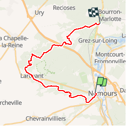
Trail Walking of 25 km to be discovered at Ile-de-France, Seine-et-Marne, Saint-Pierre-lès-Nemours. This trail is proposed by meillon.
Description
dynamique
Positioning
Country:
France
Region :
Ile-de-France
Department/Province :
Seine-et-Marne
Municipality :
Saint-Pierre-lès-Nemours
Location:
Unknown
Start:(Dec)
Start:(UTM)
476619 ; 5346211 (31U) N.
Comments