


Canal latéral de la Loire

papajp
User

Length
6.2 km

Max alt
164 m

Uphill gradient
43 m
Km-Effort
6.7 km

Min alt
132 m

Downhill gradient
43 m
Boucle
Yes
Creation date :
2024-09-21 13:23:05.0
Updated on :
2024-09-21 14:10:13.481

FREE GPS app for hiking
 SityTrail
IGN / Geographical institutes
SityTrail Plus
The world is yours!
About
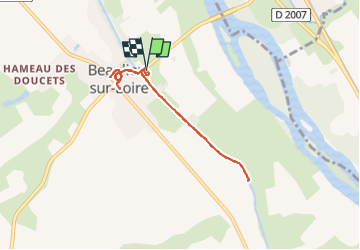
Trail of 6.2 km to be discovered at Centre-Loire Valley, Loiret, Beaulieu-sur-Loire. This trail is proposed by papajp.
Positioning
Country:
France
Region :
Centre-Loire Valley
Department/Province :
Loiret
Municipality :
Beaulieu-sur-Loire
Location:
Unknown
Start:(Dec)
Start:(UTM)
486610 ; 5265621 (31T) N.
Comments